படிமம்:Madurai 1854.jpg
Jump to navigation
Jump to search
மூலக்கோப்பு (6,336 × 5,296 படவணுக்கள், கோப்பின் அளவு: 19.17 MB, MIME வகை: image/jpeg)
சுருக்கம்
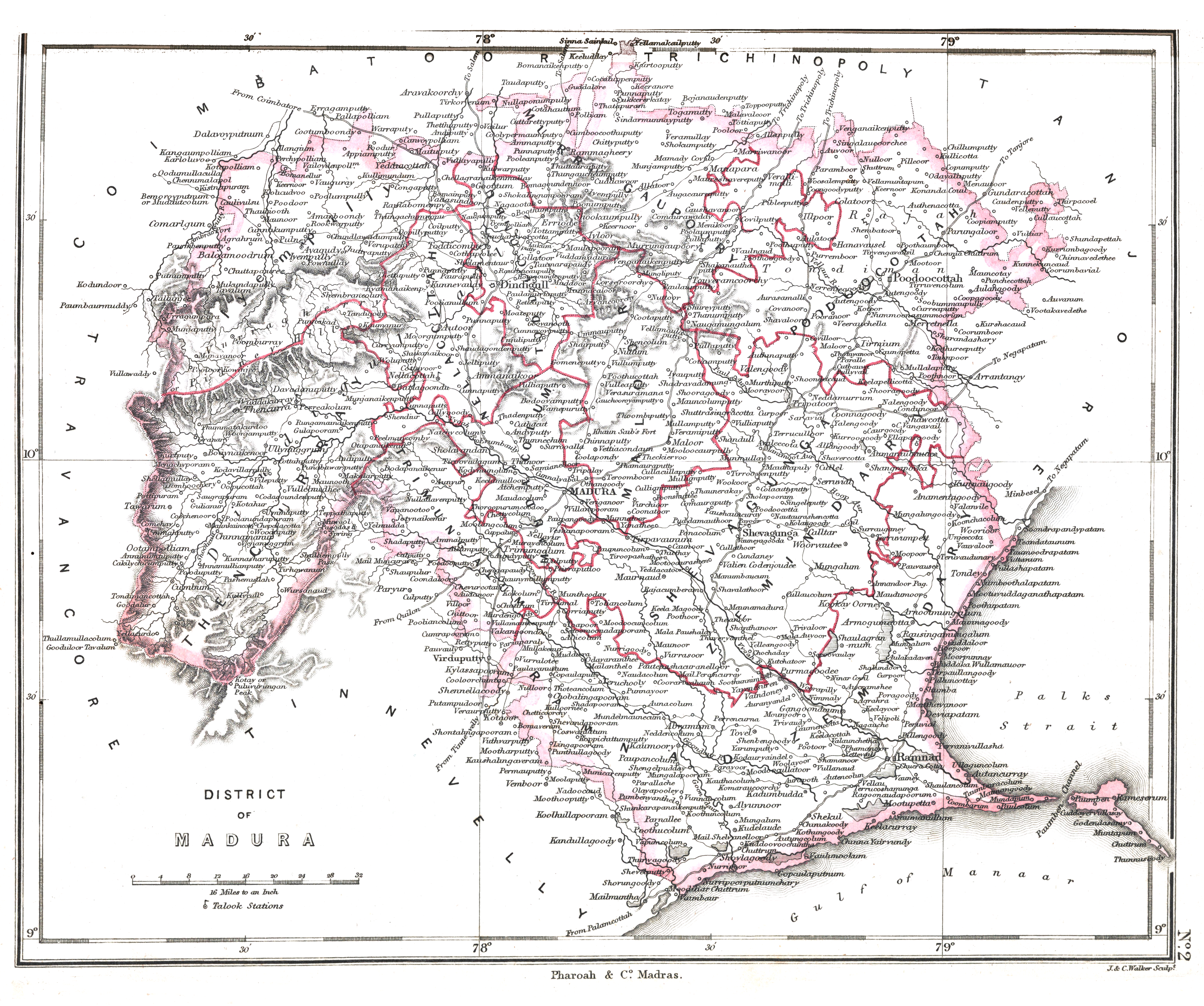
| Description |
Madurai district ca. 1854 |
|||||||||
| நாள் | ||||||||||
| மூலம் | An atlas of the southern part of India : including plans of all the principal towns and cantonments, reduced from the Grand trigonometrical survey of India showing also the Tenasserim Province | |||||||||
| படைப்பாளி |
J. & C. Walker; Pharoah and Co. Madras |
|||||||||
| அனுமதி (இக்கோப்பை மீண்டும் பயன்படுத்துதல்) |
|
|||||||||
| Geotemporal data | ||||||||||
| Date depicted | ||||||||||
| Bounding box |
|
|||||||||
| Georeferencing | ||||||||||
கோப்பின் வரலாறு
குறித்த நேரத்தில் இருந்த படிமத்தைப் பார்க்க அந்நேரத்தின் மீது சொடுக்கவும்.
| நாள்/நேரம் | நகம் அளவு சிறுபடம் | அளவுகள் | பயனர் | கருத்து | |
|---|---|---|---|---|---|
| தற்போதைய | 04:34, 30 சனவரி 2020 | சிறுதோற்றம் இல்லை | 6,336 × 5,296 (19.17 MB) | wikimediacommons>Shyamal | == {{int:filedesc}} == {{Map |Description=Madurai district ca. 1854 |Source=[https://searchworks.stanford.edu/view/12089476 An atlas of the southern part of India : including plans of all the principal towns and cantonments, reduced from the Grand trigonometrical survey of India showing also the Tenasserim Province] |Date=1854 | map_date= 1854 |Author=J. & C. Walker; Pharoah and Co. Madras |Permission={{pd-old-70}} |other_versions= }} Category:Maps of Tamil Nadu |
கோப்பு பயன்பாடு
பின்வரும் பக்க இணைப்புகள் இப் படிமத்துக்கு இணைக்கபட்டுள்ளது(ளன):