
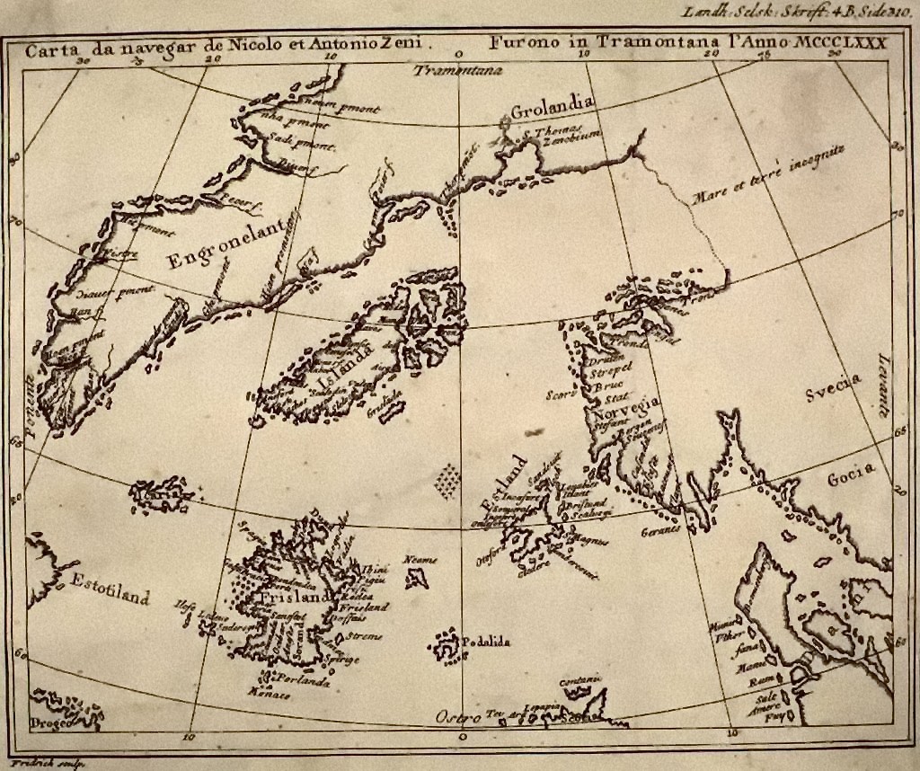
படிமம்:Map by nicolo zeno 1558.jpg
இந்த முன்னோட்டத்தின் அளவு: 250 × 209 படப்புள்ளிகள் . மற்ற பிரிதிறன்: 1,024 × 858 படப்புள்ளிகள் .
மூலக்கோப்பு (1,024 × 858 படவணுக்கள், கோப்பின் அளவு: 299 KB, MIME வகை: image/jpeg)
சுருக்கம்
| விளக்கம் | |
| நாள் | |
| மூலம் | Henrich Peter von Eggers, Priisskrift om Grønlands Østerbygds sande Beliggenhed (1793) |
| ஆசிரியர் | Nicolo Zeno |
அனுமதி
|
This work is in the public domain in its country of origin and other countries and areas where the copyright term is the author's life plus 100 years or fewer. This work is in the public domain in the United States because it was published (or registered with the U.S. Copyright Office) before January 1, 1931. | |
| This file has been identified as being free of known restrictions under copyright law, including all related and neighboring rights. | |
கோப்பின் வரலாறு
குறித்த நேரத்தில் இருந்த படிமத்தைப் பார்க்க அந்நேரத்தின் மீது சொடுக்கவும்.
| நாள்/நேரம் | நகம் அளவு சிறுபடம் | அளவுகள் | பயனர் | கருத்து | |
|---|---|---|---|---|---|
| தற்போதைய | 19:08, 22 செப்டெம்பர் 2020 | | 1,024 × 858 (299 KB) | wikimediacommons>Hohum | Cleanup |
கோப்பு பயன்பாடு
பின்வரும் பக்க இணைப்புகள் இப் படிமத்துக்கு இணைக்கபட்டுள்ளது(ளன):