படிமம்:Map Roumanophone World.png
Jump to navigation
Jump to search
இந்த முன்னோட்டத்தின் அளவு: 280 × 130 படப்புள்ளிகள் . மற்ற பிரிதிறன்: 1,357 × 628 படப்புள்ளிகள் .
மூலக்கோப்பு (1,357 × 628 படவணுக்கள், கோப்பின் அளவு: 35 KB, MIME வகை: image/png)

|
This map image could be re-created using vector graphics as an SVG file. This has several advantages; see Commons:Media for cleanup for more information. If an SVG form of this image is available, please upload it and afterwards replace this template with
{{vector version available|new image name}}.It is recommended to name the SVG file “Map Roumanophone World.svg”—then the template Vector version available (or Vva) does not need the new image name parameter. |
சுருக்கம்
| விளக்கம் |
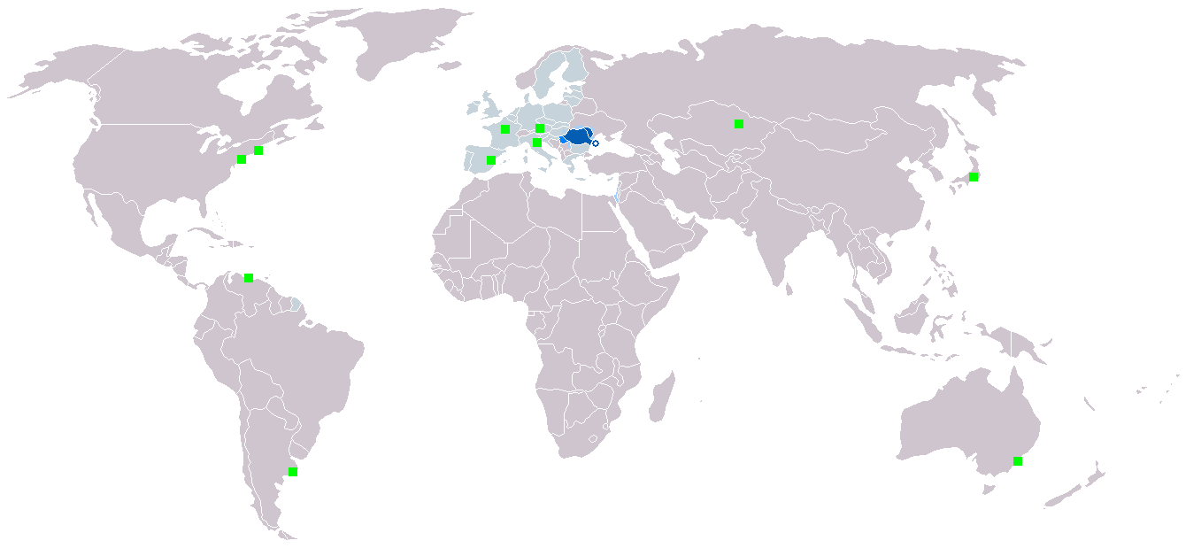
English: Map of the Roumanophone World (Romanian is an official and working language of the EU).
Legend:
Italiano: La mappa mostra la distribuzione geografica della lingua rumena.
Legenda:
Polski: Legenda:
Română: Legendă:
|
| நாள் | Originally uploaded in 2006 |
| மூலம் | சொந்த முயற்சி |
| ஆசிரியர் | Originally uploaded by Danutz |
அனுமதி
இந்த ஆக்கத்தின் காப்புரிமையாளரான நான் இதனைப் பின்வரும் உரிமத்தின் கீழ் வெளியிடுகின்றேன்:

|
GNU Free Documentation License விதிமுறைகளின் கீழ் இந்த ஆவணத்தை நகலெடுக்க, விநியோகிக்க மற்றும்/அல்லது மாற்றுவதற்கு அனுமதி வழங்கப்பட்டுள்ளது, Free Software Foundation;ஆல் வெளியிடப்பட்ட பதிப்பு 1.2 அல்லது அதற்குப் பிந்தைய பதிப்பு, மாற்றமில்லாத பிரிவுகள், முன் அட்டை உரைகள் மற்றும் பின் அட்டை உரைகள் இல்லாமல் வெளியிடப்பட்டது. GNU Free Documentation License என்ற தலைப்பில் உரிமத்தின் நகல் சேர்க்கப்பட்டுள்ளது. |
| இந்த கோப்பு Creative Commons Attribution-Share Alike 3.0 Unported உரிமத்தின் கீழ் உள்ளது. | ||
| ||
| This licensing tag was added to this file as part of the GFDL licensing update. |
கோப்பின் வரலாறு
குறித்த நேரத்தில் இருந்த படிமத்தைப் பார்க்க அந்நேரத்தின் மீது சொடுக்கவும்.
| நாள்/நேரம் | நகம் அளவு சிறுபடம் | அளவுகள் | பயனர் | கருத்து | |
|---|---|---|---|---|---|
| தற்போதைய | 09:21, 7 மார்ச்சு 2018 | | 1,357 × 628 (35 KB) | wikimediacommons>Maphobbyist | Montenegro and South Sudan borders |
கோப்பு பயன்பாடு
பின்வரும் பக்க இணைப்புகள் இப் படிமத்துக்கு இணைக்கபட்டுள்ளது(ளன):