
படிமம்:Mali.A2001291.1045.250m.jpg
இந்த முன்னோட்டத்தின் அளவு: 280 × 210 படப்புள்ளிகள் . மற்ற பிரிதிறன்: 4,000 × 3,000 படப்புள்ளிகள் .
மூலக்கோப்பு (4,000 × 3,000 படவணுக்கள், கோப்பின் அளவு: 1.75 MB, MIME வகை: image/jpeg)
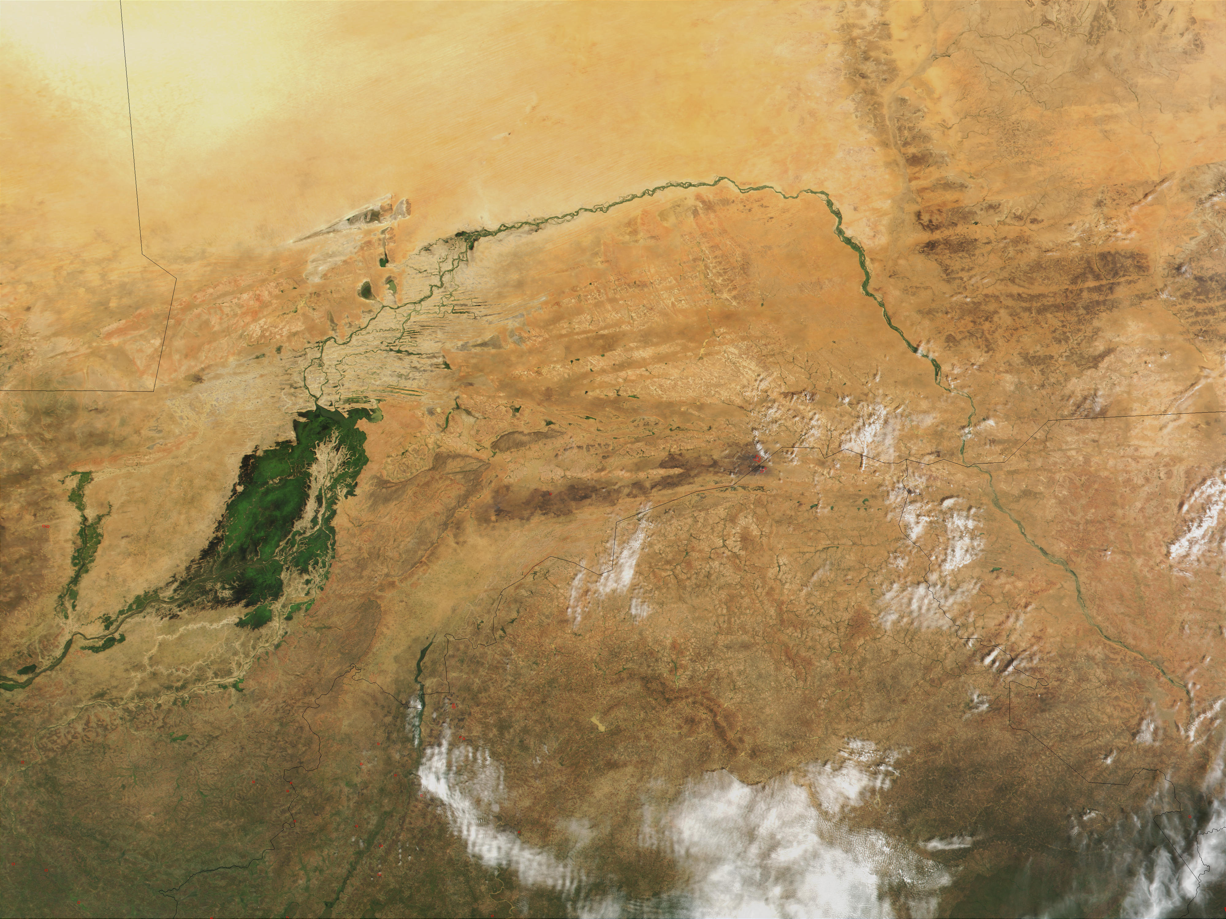
| விளக்கம் | Niger River in Mali, 2001. Just south of the Sahara Desert in Africa, the Niger River creates a lush area of wetlands and lakes in an otherwise arid environment. In this true-color MODIS image from October 18, 2001, the Niger enters at left as a thin strip of green and flows northeast through Mali. The river then turns south and heads into the country of Niger. (Note, this is at the end of the rainy season, showing the Niger Inland Delta in dark green). | |||||
| நாள் |
Visualization Date 2001-10-18 |
|||||
| மூலம் | http://veimages.gsfc.nasa.gov/2243/Mali.A2001291.1045.250m.jpg | |||||
| ஆசிரியர் | Jacques Descloitres, MODIS Land Rapid Response Team, NASA/GSFC | |||||
| அனுமதி (இக்கோப்பை மீண்டும் பயன்படுத்துதல்) |
PD, US Gov
|

கோப்பின் வரலாறு
குறித்த நேரத்தில் இருந்த படிமத்தைப் பார்க்க அந்நேரத்தின் மீது சொடுக்கவும்.
| நாள்/நேரம் | நகம் அளவு சிறுபடம் | அளவுகள் | பயனர் | கருத்து | |
|---|---|---|---|---|---|
| தற்போதைய | 22:43, 8 மார்ச்சு 2008 | | 4,000 × 3,000 (1.75 MB) | wikimediacommons>T L Miles | {{Information |Description=Niger River in Mali, 2001. Just south of the Sahara Desert in Africa, the Niger River creates a lush area of wetlands and lakes in an otherwise arid environment. In this true-color MODIS image from October 18, 2001, the Niger en |
கோப்பு பயன்பாடு
பின்வரும் பக்க இணைப்புகள் இப் படிமத்துக்கு இணைக்கபட்டுள்ளது(ளன):